
Bordeaux to Armillac: life in the Dropt Valley
209 residents, no castle, a modest church—and yet a story worth telling in detail: a Gallo-Roman name ending in “-ac,” rolling countryside between Marmande and Duras, and a small village that, bucking the trend, is seeing its population grow. About 1 hour and 35 minutes from Bordeaux.
Armillac at a Glance
- Armillac (the residents of Armillac) is a rural commune in eastern Lot-et-Garonne, in the Val du Dropt canton and the Pays de Lauzun Community of Communes—INSEE code 47014, ZIP code 47800.
- A very small area: 7.77 km² (777 hectares) of hills ranging in elevation from 60 to 139 meters—locations that can be found on the official Géoportail map (accessed July 24, 2026).
- 209 residents as of 2023 — data from the INSEE municipal record 47014 (accessed July 24, 2026).
- A name ending in “-ac”: the toponymic hallmark of a Gallo-Roman estate, a linguistic relic characteristic of the entire Occitan Southwest.
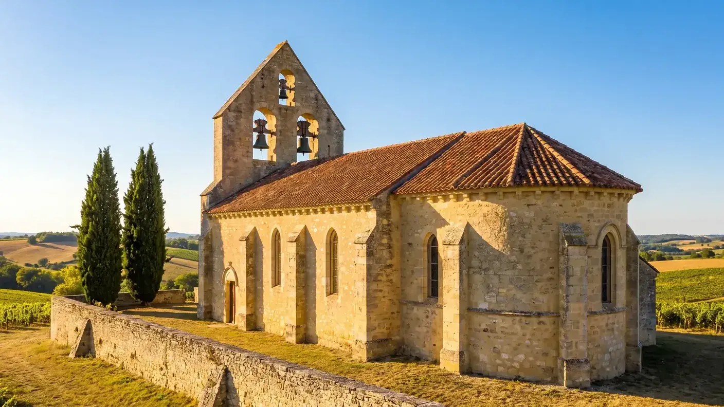
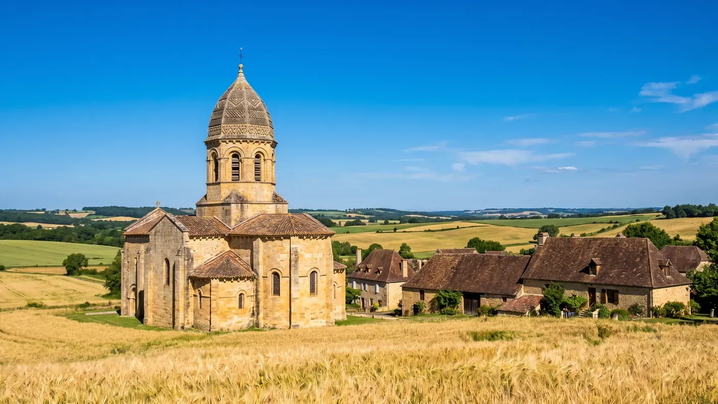
- A 15th-century Notre-Dame church with a bell wall featuring three openings—unassuming, not listed as a historic monument, but very real.
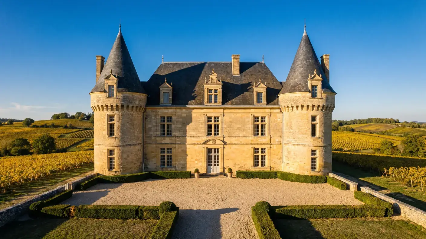
- No castles or manors are recorded: Armillac has never been the scene of major events. Its history is the quieter one of rural continuity.
- Just outside the Duras vineyard (~24 km) but outside the Côtes de Duras AOC: a distinction worth noting.
- From Bordeaux: ~115 km, about 1 hour and 35 minutes via the A62 and the Garonne Valley — starting at €206 with a private driver, door-to-door. No train station, no regular bus service.
Before You Go: What Armillac Is Really Like
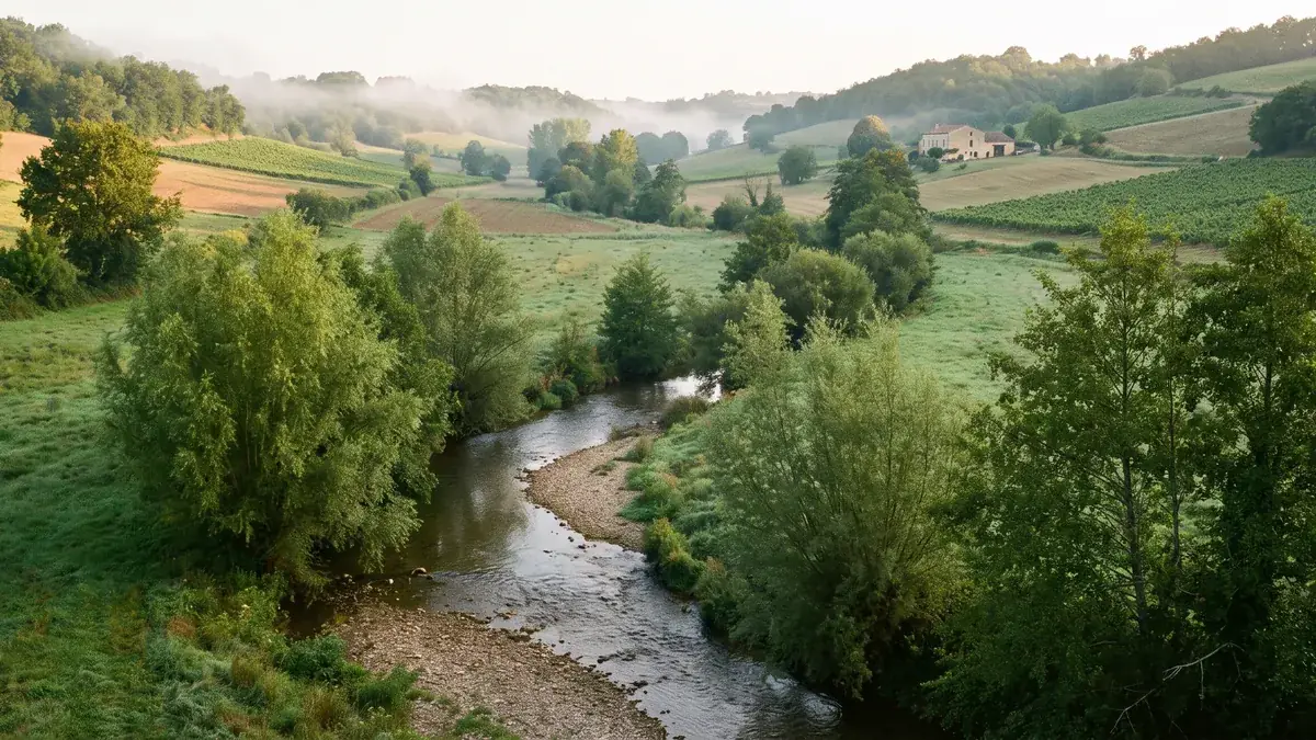
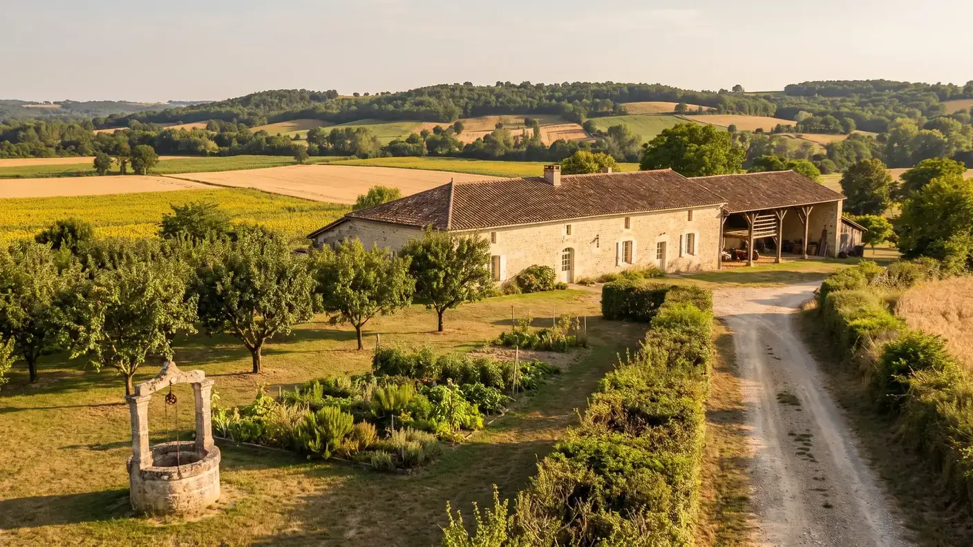
One morning in July, in the hills of the Val du Dropt. All around you, fields of ripe wheat and sunflowers roll all the way to the oak forests, dotted with light-colored stone farmhouses with tiled roofs. No castle overlooking the valley, no crowds, no sign proclaiming it the “most beautiful village.” Just a bell tower peeking out above the hedgerows, a few scattered hamlets—Le Moulin, Le Pigeonneau—and a silence that has remained almost unchanged since, fifteen centuries ago, a Gallo-Roman landowner gave his name to these lands. Welcome to Armillac, one of those villages that has never made headlines—and that is precisely what makes it so special.
Armillac is a farming village of 209 residents, one of hundreds in eastern Lot-et-Garonne. It is by no means a major tourist destination: no listed monuments, no grand feudal history, no famous figures born within its walls. What it does offer is something else entirely—a rolling landscape of mixed farming, a 15th-century rural church, a handful of hamlets whose names reflect the economy of days gone by, and a quiet location at the heart of the Marmande–Duras–Bordeaux triangle.
This guide has a clear focus: to state only what has been verified. When it comes to such a small village, many online sources pile up enticing but unsubstantiated details—a fanciful Occitan pronunciation, an early attestation dated “1520,” a debate among five linguists on the origin of the name, a church “from 1465”… None of this can be verified for Armillac (often, these are homonyms from other departments). We stick to the established facts: the geography, the actual demographics, the place names ending in “-ac,” the church, the hamlets, and the proximity—though not part of it—to the Duras vineyards.
In terms of logistics, Armillac is a transportation dead end: there’s no train station (rail service runs through Marmande), and no regular bus routes pass through the village. To get here from Bordeaux—about 1 hour and 35 minutes via the highway—and leisurely explore this corner of the countryside, from the Duras vineyards to the neighboring bastides, a chauffeur service from Bordeaux remains the only true door-to-door solution.
209 residents spread across 777 hectares of rolling hills
Armillac is located in the eastern part of Lot-et-Garonne, in Nouvelle-Aquitaine, a few kilometers from the border with the Dordogne. The municipality is part of the Marmande arrondissement, the Val du Dropt canton (an administrative division created in 2015 that replaced the former Lauzun canton), and the Pays de Lauzun Community of Municipalities. The village is located at coordinates 44°33′29″ north and 0°23′14″ east, on a rolling plateau between the Dropt Valley and the Marmandais hills.
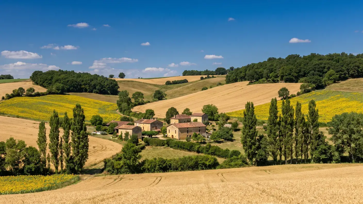
With an area of 7.77 km² (777 hectares), Armillac is one of the smallest municipalities in the region. The terrain is gentle but distinct: elevations range from 60 meters at the lowest points, along the streams, to 139 meters on the higher ground—a classic rolling landscape of Lot-et-Garonne, between agricultural plains and wooded hills. Land use patterns confirm this: according to the Corine Land Cover inventory, nearly 87% of the territory is agricultural (84% of which is arable land), with only 13% covered by forests.
The area is crisscrossed by several small waterways—the Lacauprade, Laperche, Quicaud, de la Forêt, and Saut du Loup streams—totaling nearly 10 km in length. An often-overlooked geographical detail: Armillac is divided between two river basins—the Dropt basin (~64% of the territory, which gives the canton its name) and the Garonne Valley basin (~36%)—both of which are part of the larger Adour-Garonne basin.
| Indicator | Value |
|---|---|
| ZIP Code / INSEE | 47800 / 47014 |
| Department / Region | Lot-et-Garonne / Nouvelle-Aquitaine |
| District / Township | Marmande / Val du Dropt |
| Intermunicipal Cooperation | Pays de Lauzun Municipal Council |
| Area | 7.77 km² (777 hectares) |
| Elevation | 60 m (min) to 139 m (max) |
| Population | 209 residents (2023) — the residents of Armillac |
| Density | ~27 people/km² |
| Demonym | Men and women from Armillac |
The five neighboring municipalities
Armillac shares its borders with five municipalities of comparable size, in a densely populated yet sparsely inhabited rural area:
- Lavergne, to the north
- Laperche, to the east
- Saint-Barthélemy-d'Agenais, to the south
- Montignac-Toupinerie, to the west
- Miramont-de-Guyenne, to the northwest—the nearest small town for shopping and services (about 8 minutes away)
Demographics: A Village Gaining Residents
This is the most interesting statistic about Armillac today. In 2023, the town had 209 residents, for a population density of 27 residents per square kilometer. A modest figure, but one that masks a real recovery: the population had fallen to 141 residents in 1999, its all-time low. Since then, it has been rising almost continuously—197 residents in 2011, 208 in 2020, and 209 in 2023.
During that period alone 2017-2023, Armillac won +5,56 % (approximately +0.9% per year). To put this figure in perspective: over the same period, the Lot-et-Garonne as a whole grew by only +0.23%, and France by +2.36%. The village has therefore grown by nearly twenty times faster than his department. For a community of 209 residents, the arrival of just a few families is enough to shift the statistics—but the trend is nonetheless real and consistent with the renewed appeal observed in several rural villages in the Southwest (peace and quiet, affordable real estate prices, remote work).
The population structure confirms this vitality. In 2022, Armillac had 90 households and 58 families, with a median age of 46. Most notably, those under 15 account for 18.8% of the population—nearly one in five residents—a far cry from the aging profile of many very small villages. Families with young children are indeed settling here.
| Age group | Percentage of the population (INSEE, 2022) |
|---|---|
| Under 15 years old | 18,8 % |
| Ages 15–29 | 12,9 % |
| Ages 30–44 | 16,3 % |
| Ages 45–59 | 19,3 % |
| Ages 60–74 | 19,8 % |
| 75 years old and older | 12,9 % |
The gender breakdown is nearly balanced — 99 men (47.8%) and 108 women (52.2%) according to the 2022 census — and the municipality had 18 immigrants or foreign nationals at that time, representing about 9% of the population: a sign of openness consistent with the area’s appeal as a place to live.
“Armillac”: a Gallo-Roman estate enshrined in its name
If there is one fascinating aspect to such an unassuming village, it is its name—for it alone tells the long history of settlement in the Southwest. But it must be interpreted with caution: while the structure of the name is firmly established, the precise identity of its founder remains a matter of speculation.
The suffix “-ac,” a relic from antiquity
The key lies in the ending: "-ac". This suffix is derived from Latin -acum, itself a Latinization of a suffix Gaulish -acos / -aco, which meant “(the estate of) .” The standard toponymic construction during the Gallo-Roman period involved adding this suffix to the name of the owner of an agricultural estate—usually a local notable—between the 1st and 5th centuries A.D. A name ending in “-ac” is therefore almost always a linguistic relic: it originally referred to the estate of a wealthy landowner in antiquity, whose given name forms the first part of the place name.
This is not just a folkloric detail. The suffix “-ac” is a powerful geolinguistic marker: it is found only in the former lands of Occitania (and, separately, in Brittany). In the northern “France d’oïl,” the same Latin suffix evolved into “-ay” or “-y.” In other words, the very name Armillac signals this territory’s deep-rooted Occitan heritage—just like hundreds of other towns in the Southwest: Cognac, Bergerac, neighboring Duras, or so many villages ending in “-ac” in the surrounding hills.
Armillius: A Hypothesis to Be Treated with Caution
That leaves the name of the ancient owner. On this point, we must be honest: contrary to what some online sources claim—which readily cite five linguists and a precise date—there is no truly documented toponymic authority for Armillac. The only verifiable hypothesis, stated in the conditional tense, is this: the village is said to owe its name to a certain Armillius, a wealthy Gallo-Roman landowner. This is plausible and consistent with the “-ac” naming convention, but it remains a supposition, not an established fact. The spelling variations and very precise dates that are sometimes cited are not confirmed.
In Occitan, the village is called Armilhac. For those who are curious, let’s focus on the essentials: whether it was called Armillius or something else, a landowner did indeed establish his estate on these hills sometime in late antiquity, and his name—distorted by fifteen centuries of Occitan and then French—can still be read today on the town’s signs. It’s a textbook example of place-name etymology in the Southwest—and a lesson in humility about what we know, and what we don’t know, about such a distant past.
A village that has remained on the sidelines of the grand feudal narratives
Let’s be frank: unlike many villages in Lot-et-Garonne and the neighboring Dordogne, Armillac has no documented medieval history. This is not an oversight on our part—it simply reflects the current state of knowledge available for this town.
No manors or castles listed
The available historical sources do not identify any feudal lordship specific to Armillac, nor any castle that would have left a mark on its history during the Middle Ages. Nor does any known mention of the village appear in common sources from the 13th to the 15th century—a period that was nonetheless rich in events in the Southwest: the Hundred Years’ War, rivalries between English and French holdings in Guyenne, and the founding of numerous bastides.
This silence does not mean that Armillac did not exist: the area has been inhabited since at least the Gallo-Roman period, as its name attests. It simply means that the village was never the scene of an event significant enough, nor the seat of a family powerful enough, to leave a mark in the chronicles and records that have survived to the present day. Caution is therefore warranted: we should write “no documented mention” rather than “nothing ever happened here,” which cannot be asserted with certainty.
Lauzun Castle—not to be confused with
It is helpful to place Armillac in its context—provided we do not invent a connection that does not exist. The village lies within the sphere of influence of the former canton of Lauzun, whose castle is one of the major landmarks in this part of Lot-et-Garonne. This remarkable building—a keep dating from the late 12th/early 13th century, a Renaissance main residence built around 1539, and its famous “Dome,” erected between 1677 and 1689 — enjoys triple protection under the Historic Monuments designation: classified in 1923, reclassified in 1963, and listed in 2017.
Lauzun Castle has left its mark on regional history, particularly through the figure of Antonin Nompar de Caumont, Duke of Lauzun, who was a favorite of Louis XIV before being exiled. But this is merely a geographical fact: there is no evidence that Armillac was ever part of the seigneury of Lauzun, nor that it shared its feudal fate. The two towns are neighbors in the same area, just a few kilometers apart, with no known feudal connection between them.
A feature, rather than a shortcoming
Rather than a shortcoming, this lack of a grand narrative is a defining characteristic in its own right. Armillac belongs to that vast category of French rural villages—numbering in the tens of thousands—that have never experienced a siege, a battle, or an illustrious lord. Their history is not found in books of battles, but in something more understated and, upon reflection, just as remarkable: the continuity of its agricultural settlement. From antiquity, when Armillius established his estate on these hills, to the present day, when 209 residents live there and the population is on the rise, it is continuity—not rupture—that constitutes Armillac’s true history. It is the story of rural France at its heart, a story that never makes the headlines but weaves the fabric of the land.
Notre-Dame Church, an unassuming 15th-century building
The most notable landmark in Armillac is its church, dedicated to Our Lady. Along with the village’s place names, it is the other defining feature of its heritage—even though, for such a small village, documentation remains scarce: most of the information about it comes from a single source, with no official heritage listing. We therefore present it as it is reported, with the necessary caution.
Date and Dedication
The church is believed to date from 15th century and is dedicated to the Blessed Virgin, like a great many rural churches built during this period in the Southwest—a time following the end of the Hundred Years’ War that saw the reconstruction of numerous religious buildings in rural areas. (One sometimes comes across a date of “1465” or a dedication “to the Assumption”: these details actually refer to churches with the same name (other towns, not Armillac.)
Rural Gothic architecture
As described, the church exhibits the classic characteristics of rural buildings in the region:
- A three-bay arcaded bell tower, also known as a wall bell tower: not a massive tower, but a simple openwork wall with openings (in this case, three) from which the bells are suspended. This simple, economical design is characteristic of countless rural churches in Lot-et-Garonne;
- a single nave with a pointed arch vault, suited to the modest size of the parish;
- a semicircular apse closing off the nave to the east, in accordance with the traditional orientation of Christian churches;
- from tall, narrow windows, which let in light while maintaining the thickness of the load-bearing walls.
Inside, there are reports of stained-glass windows, a wooden pulpit and a white marble altar — the latter likely installed during a later renovation (18th or 19th century), as is often the case in rural churches.
A building that isn't listed as a historic landmark, but is very real
Let’s be clear: the church in Armillac is listed neither as a classified historic monument nor as a registered historic monument. This is by no means a judgment on its value—a great many 15th-century rural churches throughout France receive no national protection simply because no steps have been taken to seek it, yet this in no way detracts from their authenticity. The Church of Notre-Dame remains a quiet but very real testament to the village’s history, serving as its anchor for six centuries.
Mills and Dovecotes: Reading the Rural Landscape
Beyond the village center and its church, Armillac consists of several hamlets scattered across its 777 hectares. These are not merely subdivisions: their names alone tell the story of the village’s traditional economic organization. Among the main localities (of which there are about thirty in the area) are Briffaud, du Galand, du Moulin, and du Pigeonneau.
The hamlet of Le Moulin and the mill
Armillac is home to a windmill, a testament to the milling industry that long shaped the local economy. Before the advent of electricity and industrial flour mills, nearly every village had its own mill—whether water- or wind-powered—to grind the harvested grain into flour on site. Armillac’s terrain, with its highest point at 139 meters, provided favorable conditions for wind.
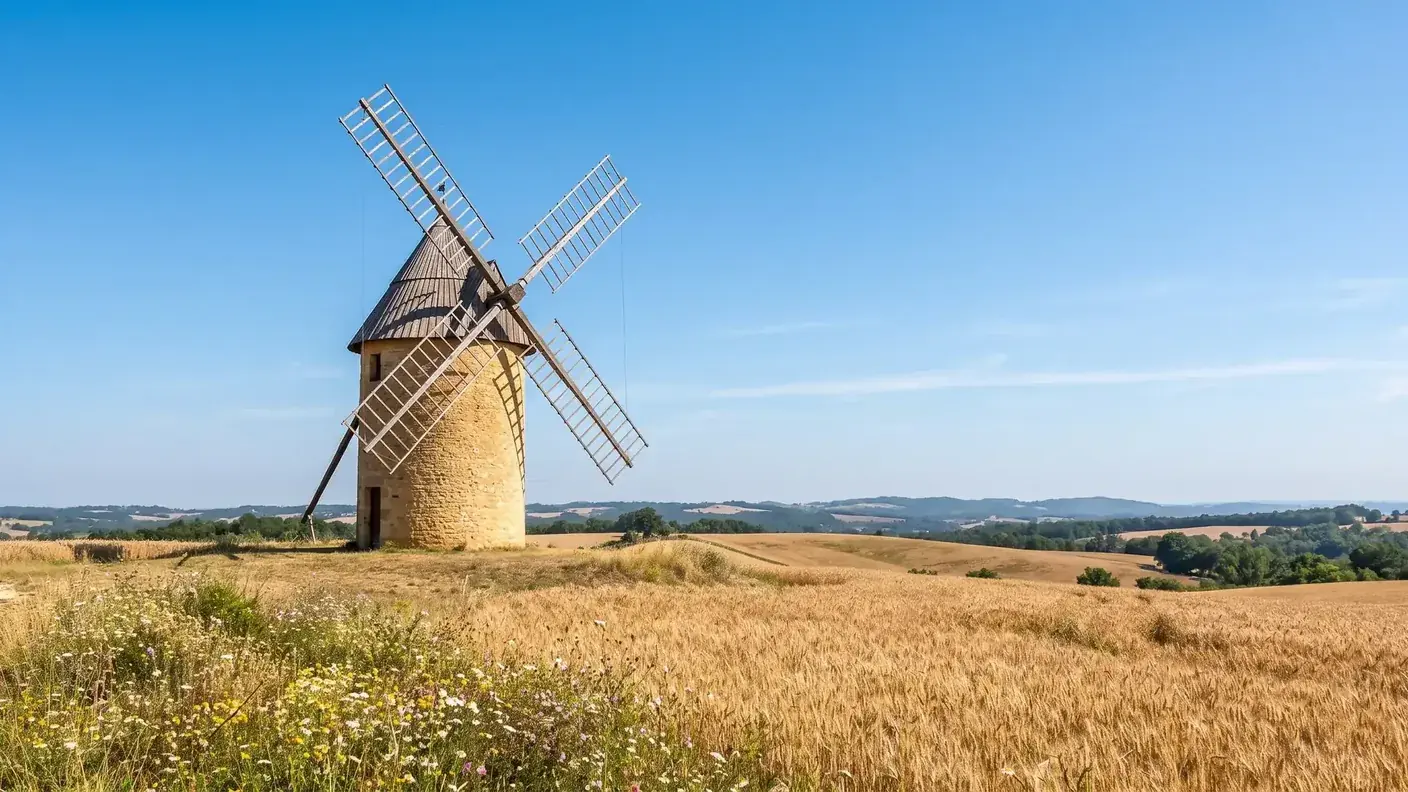
This is by no means a trivial matter at the departmental level: the census of In 1810, there were no fewer than 480 windmills in Lot-et-Garonne, these cylindrical towers topped with a pivoting conical roof. The Armillac mill is part of this rich regional tradition—even though the direct link between the locality known as “du Moulin” and this specific building is not formally documented.
The hamlet of Le Pigeonneau and the dovecote
The name “du Pigeonneau,” for its part, evokes the tradition of the dovecote, a highly distinctive architectural feature of the countryside in southwestern France. Historically, the right to keep a dovecote was often reserved for the wealthiest landowners; the dovecote served a dual economic purpose—providing meat (squab) and, above all, colombine, a nutrient-rich manure used as fertilizer before the advent of chemical fertilizers.
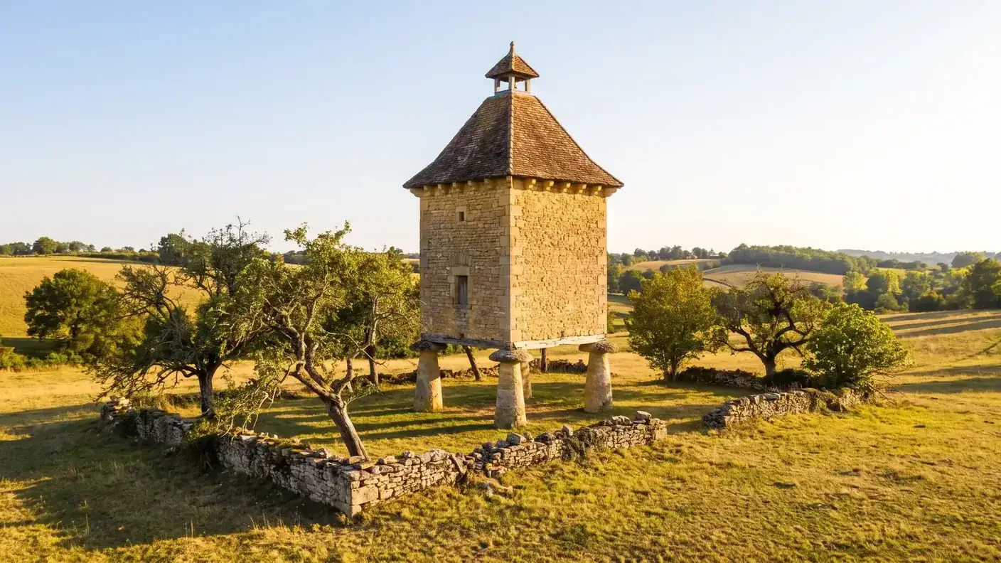
We must, however, be honest: while the dovecote is indeed a defining feature of the regional landscape, there is no formal documentation proving that the place name “du Pigeonneau” in Armillac refers to a specific right to keep a dovecote. The name evokes a tradition; it does not prove a specific historical fact. With that caveat in mind, the text remains enlightening.
Discover the History Behind Place Names
What makes Armillac interesting is that one can almost trace its economic history simply by looking at the list of its hamlets. Without archives or historical records, the names “du Moulin” and “du Pigeonneau” are enough to evoke a mixed farming and livestock-raising economy: grain crops processed on-site, livestock farming, and the ingenious use of local resources. Even today, agriculture remains the dominant activity—dairy farming, tobacco, and grain production—on land that is 84% arable. Another way—more modest but just as valid as the great feudal chronicles—to tell the story of a village: through the landscape and the words that have survived.
On the outskirts of the Duras wine region—but outside the AOC
Here’s a point that needs to be clarified precisely, as the proximity between the two can be confusing. Armillac is located about 24 km from Duras, the small town that lends its name to one of the renowned wine regions of Lot-et-Garonne: the Côtes de Duras AOC. The village lies on the edge of the vineyard—yet it is not part of it.
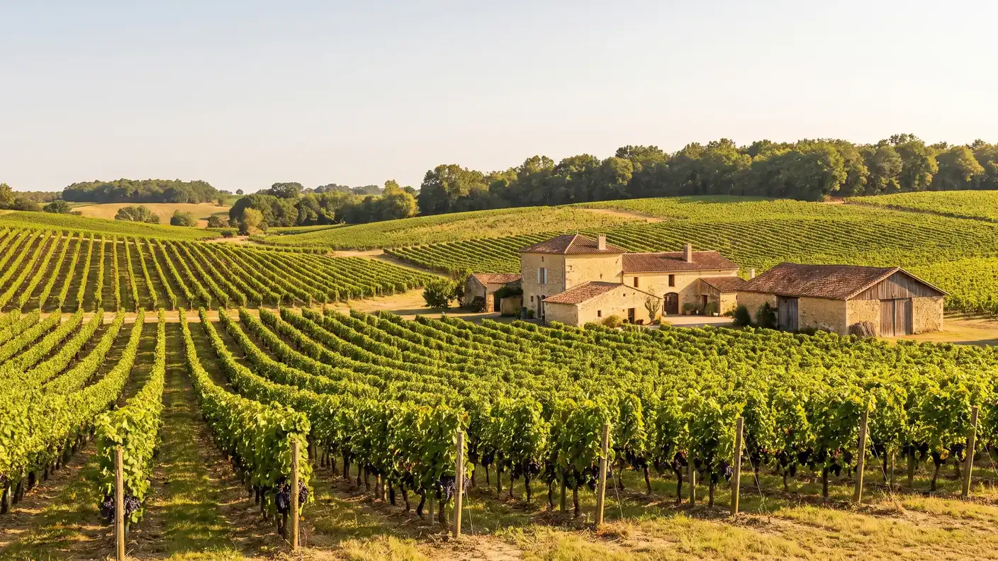
One of France's oldest AOCs
The Côtes de Duras appellation is far from being merely a footnote: it is recognized by decree as of February 16, 1937, making it one of the very first French AOCs. Its production area, initially set at 13 municipalities, was expanded to 15 municipalities by a decree dated August 3, 1946. The vineyard occupies a plateau at the junction of three wine-growing departments—its immediate vicinity even extends into the Dordogne and the Gironde neighbors.
The 15 municipalities of the appellation
The Côtes de Duras AOC currently includes the following municipalities, all located around Duras:
- Duras, Auriac-sur-Dropt, Baleyssagues, Esclottes, Loubès-Bernac, Moustier, Pardaillan;
- Saint-Astier, Saint-Jean-de-Duras, Saint-Sernin, Sainte-Colombe-de-Duras;
- La Sauvetat-du-Dropt, Savignac-de-Duras, Soumensac, and Villeneuve-de-Duras.
Armillac is not part of the AOC
Let’s be clear: Armillac is not one of the municipalities included in the Côtes de Duras appellation. The official INAO profile and its 2025 specifications list a geographical area comprising 15 municipalities, excluding Armillac (accessed July 24, 2026). The village is therefore close to Duras, but outside the appellation.
The boundaries of an AOC are not determined solely by distance; they are based on criteria related to soil, exposure, and parcel demarcation that have been validated by the INAO. Many towns neighboring a prestigious vineyard do not belong to its appellation, though this in no way diminishes their identity. For visitors, the best way to describe Armillac is therefore this: a village at the gateway to the Duras vineyard, in a landscape where vineyards play a significant role, but outside the appellation itself. It’s a nuance worth knowing—not a disappointment.
What to See Around Armillac
You can explore Armillac in half a day, ideally combined with a visit to its much more substantial neighboring towns. The village is at the center of a string of small towns and bastides, all less than an hour away. Here are the actual driving distances from Armillac:
| Destination | Distance / time from Armillac | Interest |
|---|---|---|
| Miramont-de-Guyenne | ~6 km · ~8 min | A country house dating from 1278, local shops and services, market |
| Lauzun | ~10 km · ~13 min | Castle (designated a historic monument three times: 1923, 1963, 2017), town of the Duke of Lauzun |
| Marmande | ~20 km · ~23 min | Subprefecture, train station, Marmande tomatoes, Notre-Dame Collegiate Church |
| Duras | ~24 km · ~28 min | Castle of the Dukes of Duras, AOC Côtes de Duras vineyard |
| Eymet / Issigeac | ~30–40 km · ~40 min | Bastides of the "Purple Périgord," renowned markets |
| Bergerac | ~46 km · ~53 min | Cyrano, the old town, vineyards, and gabarres on the Dordogne |
A geographer’s note: Armillac lies almost equidistant from Marmande and Duras (about 20 kilometers from each), at the heart of a Marmande–Duras–Bergerac triangle. It’s a quiet, central hub from which to explore the countryside between Guyenne and Périgord—provided you have a car, since public transportation is virtually nonexistent there.
When to Visit Armillac
Armillac doesn't really have a "tourist season" per se: it's a country village that's pleasant to visit whenever the light and the crops make it so. The decision to visit depends mainly on the scenery and events in nearby towns (markets, vineyards).
| Period | Atmosphere | Good to Know |
|---|---|---|
| Spring (April–June) | Green hills, orchards in bloom, tranquility | The Best Light; Outdoor Markets Are Opening Up Again |
| Summer (July–August) | Ripe wheat and sunflowers, dry heat | The picture-perfect landscape of the Val du Dropt; nearby night markets |
| Fall (Sept–Oct) | Grape Harvest Around Duras, Warm Colors | Grape Harvest Season — Wine Tastings and Local Wine Festivals |
| Winter (Nov–March) | Bare countryside, absolute silence | Not much going on; best suited for those who enjoy rural tranquility |
To combine a visit to Armillac with the Duras vineyards or a bastide (Miramont, Eymet, Issigeac), plan your trip for a market day—it’s a chance to experience the true spirit of this corner of Guyenne, much more so than the village itself, which is inevitably rather unassuming.
Getting to Armillac from Bordeaux
Armillac is about 115 km from Bordeaux, which is nearly 1 hour and 35 minutes by car via the A62 and the Garonne Valley, followed by the departmental roads in the Marmande region. Since the village has neither a train station nor regular bus service, it is accessible almost exclusively by car.
| Fashion | Duration | Estimated cost | Details |
|---|---|---|---|
| Chauffeured transfer | ~1 hour 35 minutes | Starting at €206 · one-way | Door-to-door service from Bordeaux, with stops at your choice (Duras, Marmande, etc.) |
| Personal car | ~1 hour 35 minutes | ~20–25 € for gas and tolls | Take the A62, then take the Marmande exit; follow the signs for Miramont / Lauzun |
| Train + Transfer | 2½–3+ hours | ~15–25 € (TER) + road trip | Take the TER to Marmande, then ~20 km without public transportation |
| Regional bus | — | — | There are no regular bus routes serving Armillac |
By car
From Bordeaux, the easiest route takes the A62 toward Toulouse, exiting at Marmande, then taking the departmental roads toward Miramont-de-Guyenne and Lauzun. Expect a distance of ~115 km and a travel time of ~1h35. Depending on the route you choose (highway or direct roads), the distance ranges from about 115 to about 120 km—in any case, a far cry from the “70 km” you sometimes see mentioned, which doesn’t correspond to any actual route.
By train
The nearest train station is Marmande, on the Bordeaux-Agen-Toulouse line (TER, about 1 hour from Bordeaux). However, there are still about 20 kilometers between Marmande and Armillac with no public transportation available: a taxi, rental car, or executive car service is therefore essential for the final leg of the journey.
By private chauffeur
For a village with such poor transportation links, a private chauffeur from Bordeaux is the simplest solution: a single door-to-door trip (~1 hr 35 min), with no transfers or last-mile arrangements to figure out, and the option to stop along the way—in Marmande, in Duras and its vineyards, or in the bastides. The fare is fixed and known in advance, starting at €206 one-way from Bordeaux.
Practical Information
- Recommended duration: half a day, to be combined with a visit to Duras, Lauzun, or a nearby bastide—Armillac itself can be explored during a short stop.
- Shops & services: None in the town; the nearest ones are in Miramont-de-Guyenne (~8 min) — supermarket, market, pharmacy, restaurants.
- Transportation: There is no train station or regular bus service. A car or chauffeured transfer is essential. The nearest TER train station is Marmande (~20 km).
- Affiliations: Val du Dropt canton, Pays de Lauzun Community of Municipalities—the first intermunicipal association established in Lot-et-Garonne, in 1993.
- Lodging: A few bed-and-breakfasts and rural guesthouses in the area; a wide range of hotel options in Marmande, Miramont, and Duras.
- Note: The Val du Dropt canton straddles two districts—Armillac falls under Marmande, while other municipalities fall under Villeneuve-sur-Lot; the central office is located in Miramont-de-Guyenne.
Frequently Asked Questions
Where does the name “Armillac” come from?
The name comes from the suffix “-ac” (from the Latin -acum, based on a Gallic root), which refers to a Gallo-Roman agricultural estate. One plausible hypothesis—though speculative—is that Armillac owes its name to a certain Armillius, a wealthy landowner from antiquity. The very precise dating and the “debates among five linguists” that are sometimes mentioned have not been confirmed for this town.
Is Armillac part of the Côtes de Duras appellation?
No. Despite its proximity (~24 km from Duras), Armillac is not one of the 15 municipalities in the Côtes de Duras AOC: its name is not included in the INAO’s specifications. It is a village with a mixed agricultural economy (dairy, tobacco, grains), located on the outskirts of the vineyard region but outside the appellation.
What is the medieval history of Armillac?
There is no documented medieval history for Armillac: no seigneury, no feudal castle, and no known mention of the village between the 13th and 15th centuries. The Château de Lauzun, located nearby (~10 km) and designated a Historic Monument, has no documented feudal connection to the town.
What is the Notre-Dame d'Armillac Church?
This is the village church, dating from the 15th century and dedicated to the Blessed Virgin. It features a bell wall (arcade bell tower) with three openings, a single nave with a pointed arch vault, and a semicircular apse. It is neither classified nor listed as a historic monument.
How many people live in Armillac?
Armillac had a population of 209 in 2023, with a population density of 27 people per square kilometer across an area of 7.77 square kilometers. The municipality had a total of 90 households and 58 families in 2022, with a median age of 46 and a significant proportion of residents under 15 (18.8%).
Why is the population of Armillac growing?
Between 2017 and 2023, Armillac saw a 5.56% increase, compared with a 0.23% increase for Lot-et-Garonne. The village’s population had fallen to 141 residents in 1999; it has since gained nearly 70 residents, driven by the renewed appeal of rural areas (peace and quiet, affordable housing prices, and remote work).
What are the hamlets of Armillac?
The town is surrounded by several hamlets, including Briffaud, du Galand, du Moulin, and du Pigeonneau. The names “du Moulin” and “du Pigeonneau” evoke the traditional rural economy—milling (a windmill is known to have existed in the town) and pigeon-rearing.
Does Armillac have a castle?
No, there are no castles listed as being specific to Armillac. The most notable castle in the area is Lauzun Castle (~10 km away), which has triple historic monument protection (classified in 1923 and 1963, listed in 2017), but there is no documented feudal connection linking it to Armillac.
How far is Armillac from Bordeaux?
Approximately 115 km, or about 1 hour and 35 minutes by car via the A62 and the Garonne Valley. With a professional chauffeur, the door-to-door trip starts at €206 one way. Be wary of the “70 km” distance sometimes mentioned: it does not correspond to any actual route.
How can you get to Armillac without a car?
It's difficult: Armillac has neither a train station nor a regular bus route. The closest station is the TER station in Marmande (~20 km, ~1 hour from Bordeaux), but from there it's still about 20 kilometers without public transportation. A private driver offering door-to-door service remains the simplest solution.
What is there to see around Armillac?
Less than an hour away: Miramont-de-Guyenne (bastide, ~8 min), Lauzun and its castle (~13 min), Marmande (~23 min), Duras and its vineyards (~28 min), the bastides of Eymet and Issigeac, and Bergerac (~53 min). Armillac is a central hub within the Marmande-Duras-Bergerac triangle.
What are the residents of Armillac called?
The residents of Armillac are known as Armillacais and Armillacaises. The municipality is part of the Val du Dropt canton and the Pays de Lauzun Community of Municipalities, in the Marmande district.
Is Armillac in the Périgord?
No: Armillac is in Lot-et-Garonne (Guyenne), even though the town is very close to the border with the Dordogne. The Périgord begins a few kilometers further north—Bergerac and the Périgord Pourpre are about 46 km away. Culturally, Armillac belongs to the Occitan world of Guyenne.
Further Reading
- The capital of the Périgord Pourpre, about 46 km away: see the Guide to Bergerac (Cyrano, gabarres, Monbazillac)
- A neighboring wine-growing village on the outskirts of the Gironde: see the Monestier Guide (unfinished bastide, Michelin-starred golf course, Saussignac)
- Another small rural village described in detail: see the Bertric-Burée Guide (millennial yew tree, Gary Gygax Alley)
- Compare before booking: Open the Bordeaux → Armillac trip details page to view the fixed price and terms, then book your chauffeur service.
Sources and References
- Wikipedia — Armillac — geography, place names, church, hamlets, land use
- INSEE — Complete Report on Armillac (47014) — Population, Households, Age Groups, RP2022
- INSEE — Regional Comparison Tool (47014) — Population Trends, Population Density
- Wikidata — Armillac (Q953311) — area, elevations, population trends
- Pays de Lauzun Community of Municipalities — Intermunicipal Cooperation, Services, Territory
- INAO — Côtes de Duras AOC Specifications — 15 municipalities within the appellation, 2025 specifications
- Wikipedia — Côtes de Duras (AOC) — 1937 decree, 1946 extension
- POP/Mérimée Database — Château de Lauzun — three designations as a historic monument (1923, 1963, 2017), dating
- Wikipedia — Val du Dropt Canton — established in 2015, municipalities, two districts
- IGN Geoportal — Municipality of Armillac — topography, hamlets, watercourses, hydrography
Article updated in July 2026.
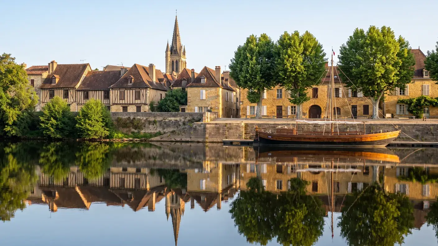
On the Way to the Val du Dropt
Direct route from Bordeaux (~1 hour 35 minutes) via the A62 and the Garonne Valley, with stops along the way as desired—Marmande, Duras and its vineyards, and the bastides of the Pays de Lauzun. Fixed-price quote in writing within 30 minutes; sedan or 8-passenger van; English-speaking driver.