
Bordeaux to Cornille: a Périgord Blanc village on the Vézelay route
Ten kilometers from Périgueux, a quiet village near the route from Vézelay to Santiago de Compostela. What truly sets it apart: a population that has doubled since 1968, bucking the trend in rural Périgord. A Romanesque church, a local patron saint, and a well-preserved manor house—all without embellishing the legends. About 1 hour and 55 minutes from Bordeaux.
Cornille at a Glance
- Cornille (known as "les Cornillais") is a village in the Périgord Blanc region of the Dordogne (24750), about ten kilometers northeast of Périgueux.
- Its uniqueness lies in its demographics: in contrast to the rural Périgord region, Cornille has seen its population more than double since 1968—from 275 to 687 residents (2023)—driven by the suburbanization of Périgueux.
- The town is located near the Via Lemovicensis, the Périgord route from Vézelay to Santiago de Compostela (GR 654); however, the national guide does not list it as an official stop.
- Its name comes from the Gallo-Roman personal name Cornelius—“Cornelius’s estate”—a trace of a long-ago ancient landowner.
- The diocesan directory lists the church in Cornille as dedicated to Saint Eutache; the attribution to Saint Eumache, which is often cited online, has not been confirmed for this town.
- The Fayardie Manor, often described as “in ruins,” is in fact a remarkably well-preserved fortified house—featuring a spiral staircase carved from a single tree trunk.
- This guide aims to separate fact from fiction: several claims circulating about Cornille (such as that it is a listed church or that it has a shell-shaped clock face) are not based on any reliable sources.
- From Bordeaux: ~145 km, about 1 hour and 55 minutes by car — starting at €249 with a private driver. No train station (Périgueux is ~10 km away).
Before You Go: What Cornille Really Is
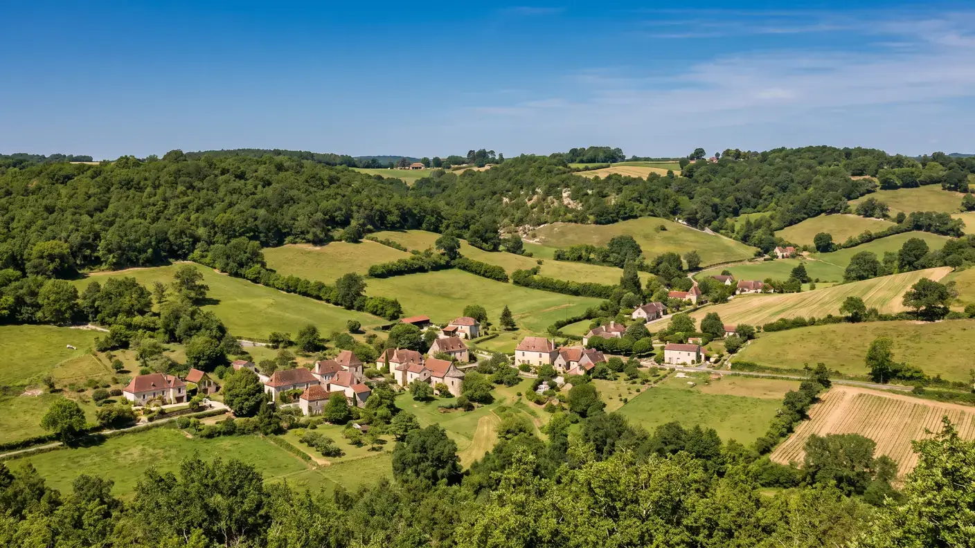
A clear morning over the limestone hills of the Périgord Blanc. Just ten kilometers from Périgueux, Cornille has neither a media-famous castle, nor a historic townhouse, nor an ornate cave. It is a quiet village, nestled among white chalk hills, through which—without fanfare—runs one of Europe’s oldest pilgrimage routes: the Way of St. James. Here you’ll find a Romanesque church dedicated to a local shepherd saint, a surprisingly well-preserved fortified manor, and above all, a population that—contrary to all expectations in rural Dordogne—continues to grow. Welcome to Cornille, a stopover village that goes unmarked by any signs, but whose story is well worth telling—provided you can separate fact from fiction.
Cornille is located in the Central Périgord, known as the “White Périgord” because of the light color of its limestone. It is a town in the outskirts of Périgueux: rural, with scattered settlements, yet within the immediate vicinity of the prefecture. People don’t come here for spectacular sights, but for the atmosphere—that of a lively country village on a path steeped in history.
The approach: distinguishing between what has been verified and what has been repeated
This guide takes a rigorous approach: it carefully distinguishes between information that is properly sourced and information that is simply copied from one entry to another. This is because, on Cornille, several widely held claims do not stand up to scrutiny. The church is not designated a historic monument (only a statue within it is protected as a cultural artifact). The famous “scallop shell sundial” and the patron saint’s “miracle of the eagle” are not documented by any primary sources. And the Croquants’ revolt, often associated with the nearby Lanmary Forest, actually took refuge elsewhere—in the Vergt Forest. We state this clearly, rather than embellishing the story.
Once the clutter is cleared away, what remains is more than enough to make the place worthwhile: a unique demographic, a key stop on the route from Vézelay to Santiago de Compostela, a charming local saint, and a rare, well-preserved manor house. To explore Cornille and nearby Périgueux at your own pace, a chauffeur service from Bordeaux remains the simplest door-to-door option.
A village in the outskirts of Périgueux, in the Périgord Blanc region
Cornille is located in the central quarter of the Dordogne, about ten kilometers north-northeast of Périgueux (about 10.5 km by road, 9 km as the crow flies). The territory, which covers 13.04 km², features a typical limestone hilly landscape—ranging in elevation from 134 to 230 meters. The subsoil is part of the Périgord Plateau: heterogeneous Cretaceous limestones (from the Turonian to the Campanian), the very same white, bright chalk that has earned the central Périgord its nickname of White Périgord.
Five neighboring municipalities, two departmental roads
The village is set apart from major thoroughfares: it is accessible via Departmental Road 8, which crosses the area from south to northeast, and via RD 69 to the north. Part of the Périgueux district and the Le Grand Périgueux metropolitan community, Cornille borders five municipalities: Agonac, Sorges-et-Ligueux-en-Périgord, Antonne-et-Trigonant, Trélissac, and Champcevinel.
| Data | Value |
|---|---|
| ZIP Code / INSEE | 24750 / 24135 |
| Natural Region | White Périgord (Central Périgord) |
| Intermunicipal Cooperation | Greater Périgueux |
| Area | 13.04 km² (INSEE cadastral area) |
| Elevation | 134 m to 230 m |
| Population | 687 residents (2023) — the residents of Cornillais |
| Density | ~53 people per km² |
| Must-See | Saint-Eutache Church, Fayardie Manor, near the Vézelay Road |
This population density of approximately 53 people per square kilometer is already a clue: it is significantly higher than that of the department’s isolated rural communities. Cornille is not a village that is losing its population—quite the contrary. In fact, that is precisely what makes it unique, as we will see.
A Rare Sight: A Growing Village in the Périgord
This is, by far, the most remarkable feature of Cornille. While the population of most villages in rural Dordogne has been declining for the past century, Cornille has been growing—and has been doing so for a long time. From 275 residents in 1968, the town’s population rose to 687 in 2023: a 2.5-fold increase in half a century.[1]
| Year | Population |
|---|---|
| 1968 | 275 residents |
| 1975 | 318 |
| 1982 | 445 |
| 1990 | 548 |
| 1999 | 562 |
| 2015 | 673 |
| 2023 | 687 residents |
The Takeoff: 1975–1990
The most intense phase occurred between 1975 and 1990: the population surged from 318 to 548 residents, an increase of 72% over fifteen years. This was the major wave of suburbanization in rural areas near prefectural capitals. Since 2016, the growth curve has leveled off at around 685–690 residents. The trend has not been perfectly linear—it has experienced slight declines—but the underlying trend is unmistakable: Cornille gained residents at a time when nearly all of rural Périgord was losing them.
What the Official Zoning Says
The explanation can be summed up in one word: the suburban belt. Cornille officially belongs to the Périgueux catchment area, of which it is a suburban town. Less than ten kilometers from the prefecture, residents can enjoy a peaceful life in a rural setting with affordable housing, while working in Périgueux or its surrounding employment area. This residential appeal, which has continued for half a century, has shaped a village that is younger and more populous than at any time during the 20th century.
Statistical zoning accurately confirms this picture. In the classification system INSEE on Urban Catchment Areas (2020), Cornille is listed in the outer ring of the Périgueux catchment area, a group that includes 49 municipalities; however, it remains outside the urban area, and its frame falls under the category "rural municipality with scattered settlements". In other words: statistically within the city’s sphere of influence, but physically still in the countryside—hamlets, isolated farms, and recent housing developments scattered across the territory’s 13 km². This is precisely the profile of the green commuter towns that have driven France’s suburban growth since the 1970s.
Finally, a word about the accuracy of the figures themselves: depending on the year used, the figures are either 688 residents (INSEE municipal population, 2022) or 687 residents (as of January 1, 2023)—both values are correct for their respective reference dates. The recent trend, however, is not a smooth, steady line: 691 residents in 2016, a slight decline to 676 in 2017, a rise to 690 in 2021, and then 687 in 2023. A slight fluctuation of a few units around a plateau—nothing that calls the underlying trend into question, but enough to remind us that “continuous growth” would be an oversimplification.
The Cornelius Estate: Gallo-Roman Origins
The name Cornille—Cornilha in Occitan—derives from the Latin male name Cornelius, borne by many prominent Romans. This is the interpretation adopted by the major toponymic dictionaries (Dauzat, Rostaing, Nègre). Cornille would thus originally have referred to the estate of a man named Cornelius, a Gallo-Roman landowner about whom nothing is known, except for this name preserved in the place name.
This type of name is a classic example throughout the Southwest. During the Gallo-Roman period, a large landowner would name his agricultural estate after himself; hundreds of French municipalities thus owe their names to a long-forgotten ancient landowner. Cornille is a clear example of this, as the name Cornelius has been passed down with almost no alteration. We remain cautious, however, regarding the morphological details: the meaning “Cornelius’s estate” is widely accepted, but one sometimes encounters old medieval forms that actually refer to another town with the same name (Cornillé, in Ille-et-Vilaine)—which should not be confused with this one.
At the gates of Vesunna, capital of the Petrocorian people
This ancient heritage is by no means a mere footnote in this region: we are just a few kilometers from Vesunna, now known as Périgueux, the capital of the Gallo-Roman city of the Pétrocores. Two thousand years ago, this entire region revolved around this Roman town—and it is no surprise that an estate there bore the name of a Cornelius. The thread connecting antiquity to the village of today has never been broken. For the sake of accuracy, however, it should be noted that no Gallo-Roman remains have been archaeologically confirmed within the territory of Cornille itself: the ancient context is regional—the very dense one of the Vesunna basin—and it is place names, not the trowel, that preserve the Roman legacy here.
A name that has traveled all the way to Mars
According to the Wikipedia page for Cornille cited at the end of the article, a rock target analyzed by the Curiosity rover in March 2021 was named “Cornille.” The name of an obscure Gallo-Roman landowner, preserved for two millennia in a place name in the Périgord Blanc region, has thus been affixed to a Martian rock studied by a mobile laboratory. Few villages with fewer than 700 inhabitants can boast such an expansion of their domain: from the Gallo-Roman villa of Cornelius to the surface of Mars, a place name has rarely traveled farther.
Cornille near the Vézelay route to Santiago de Compostela
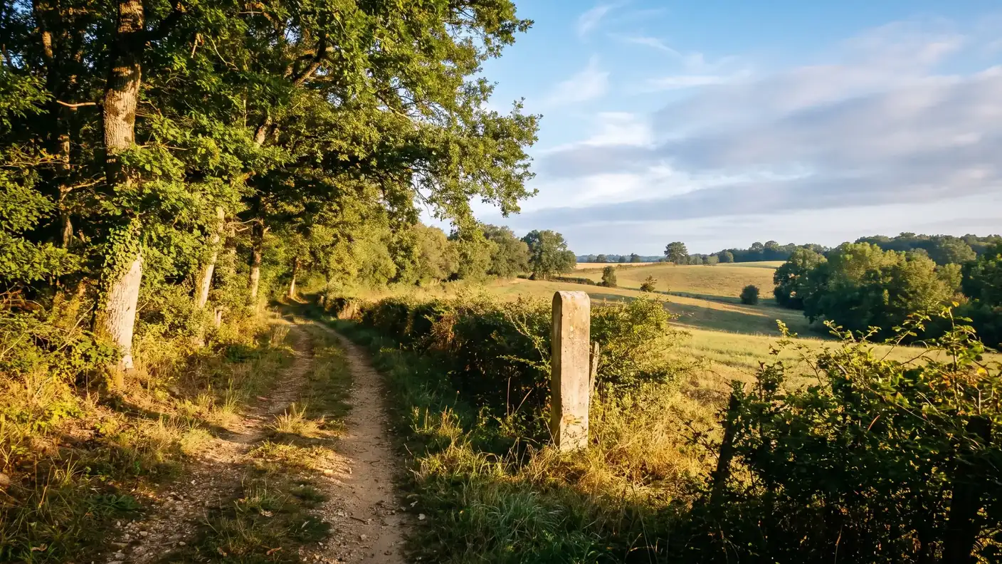
The French Agency for the Ways of St. James identifies the Via Lemovicensis as the Vézelay Route, a 1,100-km itinerary linked to the GR 654, which crosses the Dordogne and passes through Périgueux. Its public profile does not specifically mention Cornille; therefore, this guide presents the town as being near this route, rather than as an officially recognized stop.[2]
What the official itinerary specifies
The route connects Vézelay to Saint-Jean-Pied-de-Port, with Périgueux among its gateway towns. There are two routes: the GR 654 trail, marked by the French Hiking Federation, and a pilgrims’ path marked by the European scallop shell and yellow and blue markers. Be sure to consult the detailed itinerary before setting out on your hike.[2]
The exact scope of UNESCO designation
The property “The Routes of Santiago de Compostela in France,” inscribed in 1998, comprises selected monuments and sections of the routes. The Saint-Front Cathedral in Périgueux is one of its components; Cornille is not listed individually as part of this inscription. The proximity of the route should therefore not be confused with a UNESCO designation for the municipality.[5]
Saint Eutache in Cornille: Distinguishing the Official Patron Saint from Saint Eumache
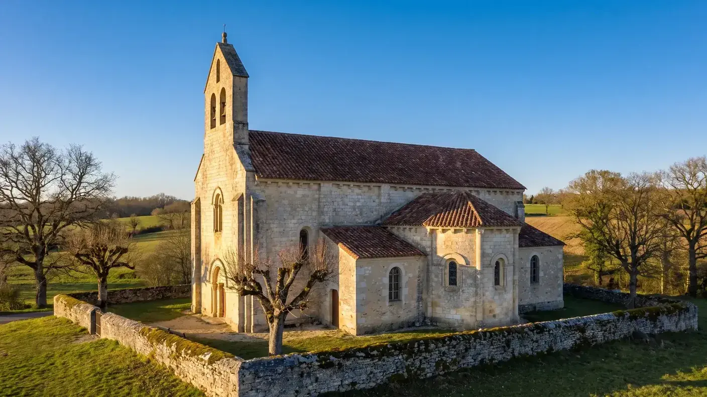
The 2022 directory of the Diocese of Périgueux and Sarlat lists “Cornille — St-Eutache,” while it explicitly associates Saint-Eumache with the town of Saint-Chamassy. This direct local source contradicts the name “Saint-Eumache Church of Cornille,” which is often cited online. The name used here is therefore Saint-Eutache.[3]
Which remains an unverified tradition
The accounts depicting a “Saint Eumache of Cornille” as a 6th-century shepherd, a servant of a Lady Boëze, and later a priest, are not corroborated by the diocesan source consulted or by any identified local archival record. They therefore represent a hagiographic tradition in this context, without being presented as the established biography of the church’s patron saint.
Confusion that should not be mistaken for certainty
The diocesan directory is sufficient to distinguish between the two names, but it does not document the building’s date of construction, its stained-glass windows, or the historical origin of this confusion. Until a parish inventory or a specific local archive is published, these details must remain as hypotheses or be omitted.
Saint-Eutache Church: A Well-Documented Heritage Site
The official name listed is “Saint-Eutache,” according to the directory of the Diocese of Périgueux and Sarlat. This source alone does not allow us to confirm a precise Romanesque date, 19th-century alterations, or the iconography of a stained-glass window. These details are therefore no longer presented as established facts.[3]
A Christ on the Cross Designated as a Cultural Object
The POP database lists a crucifix at Cornille under the identifier PM24000153, which was classified as an object on February 20, 1961. This designation applies to the religious artifact, not the entire church; therefore, the statement “church designated as a Historic Monument” would be inaccurate.[4]
The shell attributed to the church
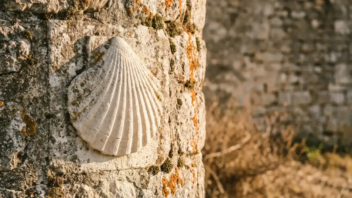
The existence of a sundial carved in the shape of a scallop shell is not supported by either the POP record for the protected object or the institutional sources consulted. This claim remains an unverified tradition. A geotagged photograph or a local heritage inventory would be necessary to confirm it.
The Fayardie Manor and the Built Heritage
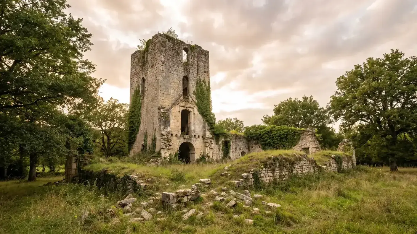
Aside from its church, Cornille boasts a modest but genuine architectural heritage—and here, too, we need to dispel a persistent misconception. The Fayardie Manor is often described as “in ruins, reduced to a single tower.” It is false: On the contrary, La Fayardie is a fortified house still standing and remarkably well-preserved, considered one of the few buildings of its kind to have undergone very few alterations.
A staircase carved from a single tree trunk
With a rectangular, single-story layout, the Fayardie is organized around a central square tower that houses an exceptional spiral staircase, carved from a single tree trunk, with triangular steps. The building retains three battlements and embrasures, evidence of its defensive function in the late Middle Ages. Now privately owned (it houses a pottery studio), it is not open to the public—but it is very much alive, anything but a ruin.
Château de la Forêt, Obelisk, and Dovecote
The rest of the area’s small-scale heritage sites round out the picture. The Château de la Forêt, built in the 15th and 17th centuries, is now a stud farm. At a place called Les Tavernes, an obelisk was erected in 1836 by the Count of Barde. Finally, the 18th-century dovecote at La Luminade serves as a reminder of a tradition typical of the Périgord: the right to keep dovecotes, long reserved for the local elite, and pigeon droppings, a valuable fertilizer for the land. These are all subtle reminders of a region that has been inhabited for a long time.
The Château de la Forêt—now known as the “Haras de la Forêt”—deserves a few more words, as its silhouette encapsulates several centuries of stately architecture: it retains a round tower, a square tower with machicolations, a parapet walk, an entrance gatehouse, and the remains of its former moat. In other words, it features the full range of 15th-century defensive elements, softened by 17th-century renovations, now put to use for the benefit of horses. With La Fayardie and its bretèches on one side, and La Forêt and its gatehouse on the other, Cornille thus brings together—within thirteen small square kilometers—two complementary examples of noble Perigord architecture: one that has remained a virtually intact fortified house, the other transformed into an equestrian estate—two private properties that can be glimpsed along the town’s roads and paths.
Nature, Access from Bordeaux and the Surrounding Area
Just outside Cornille lies the vast Lanmary Forest, a state-owned forest of oak and chestnut trees that is now designated as a Natural Area of Ecological Interest (ZNIEFF). It’s a beautiful destination for a walk, on the outskirts of town. It is sometimes claimed that this forest served as a refuge for the Croquants, the rebellious peasants of the 17th century; in reality, the historically documented refuge of their last leader, Pierre Grellety, was the Vergt Forest, further south—Lanmary, for its part, remains first and foremost a natural site. So explore it for its trees, not for a legend.
Les Croquants: The True Story, Without Embellishment
Since the name “Croquants” comes up whenever the forests of the Périgord are mentioned, we might as well recount what the sources actually say about these peasant revolts—one of the greatest stories of modern Périgord. There were, in fact, two waves. The first broke out as early as 1594, near Turenne, in the wake of the Wars of Religion; it was quelled in September 1595 during clashes at Saint-Crépin-d’Auberoche and Condat-sur-Vézère—that is, just a few leagues southeast of Cornille. The second, more massive wave engulfed the Périgord in 1636–1637, driven by the crushing tax burden associated with the war against Spain.
In 1637, a country gentleman, La Mothe de la Forêt, takes command of a peasant army of about 8,000 men and captures Bergerac. The royal counterattack is led by the Duke of La Valette, with about 3,000 soldiers seasoned: the June 1, 1637, at La Sauvetat-du-Dropt, he crushed the uprising in a clash of rare violence—the death toll ranges from one a thousand deaths more than 1,600 killed According to sources, there were about 40 prisoners. More than 2,000 rebels had taken refuge behind the town walls, under the command of the Lord of Madaillan… who fled in the midst of the battle.
There was one die-hard left: Pierre Grellety, the “last resistance fighter,” who held out in the maquis for about four years in the Vergt Forest — and not in Lanmary, let’s be clear. His story is a novel in itself: he was granted amnesty on January 25, 1642, he was then appointed Captain and Governor of Vercelli, in Italy—from outlaw logger to military governor, the most spectacular transformation in the entire history of the Croquants. One last misconception to avoid: the famous "Jacquou the Crunchy" fromEugène Le Roy, set in the Périgord region of the Vézère Valley, does not take place during these revolts but during the Restoration, in the 19th century — Its title is a retrospective reference to the insurgents of the 16th and 17th centuries, not a chronicle of their history.
| Date | The Croquants Episode |
|---|---|
| 1594 | First wave of revolt, starting with Turenne |
| September 1595 | Repression in Saint-Crépin-d'Auberoche and Condat-sur-Vézère |
| 1636-1637 | Second Wave, Against a Backdrop of Tax Burden and the Spanish Civil War |
| 1637 | La Mothe de la Forêt raises a force of about 8,000 men; the capture of Bergerac |
| June 1, 1637 | Defeat of La Sauvetat-du-Dropt at the hands of the Duke of La Valette (~3,000 soldiers) |
| 1637-1641 | Pierre Grellety continues the fight from the Vergt Forest |
| January 25, 1642 | Amnesty granted by Grellety, who later became governor of Vercelli (Italy) |
Getting to Cornille from Bordeaux
In terms of access, Cornille does not have a train station: the nearest one is in Périgueux, about ten kilometers away. From Bordeaux, it’s approximately 145 km and 1 hour and 55 minutes by car. The prefecture, Périgueux, is only a quarter of an hour away (~10 km)—this is Cornille’s greatest asset, being both in the countryside and on the outskirts of the city.
| From / To | Distance | Weather |
|---|---|---|
| Bordeaux → Cornille | ~145 km | ~1 hour 55 minutes |
| Périgueux (prefecture) | ~10 km | ~15 min |
| Brantôme | ~16 km | ~20 min |
| Sorges (the truffle capital) | ~10 km | ~12 min |
| Sarlat-la-Canéda | ~75 km | ~1 hour 10 minutes |
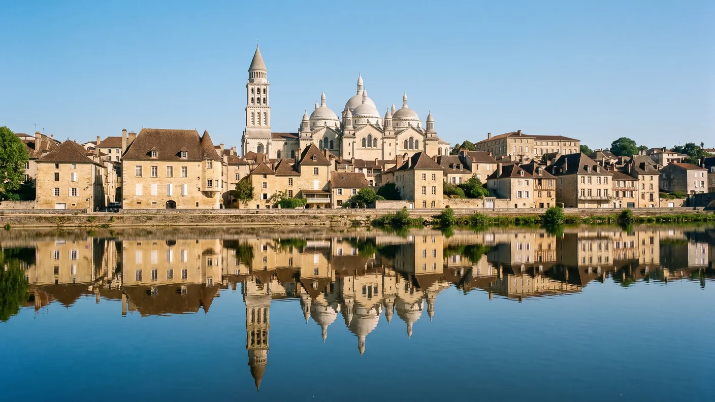
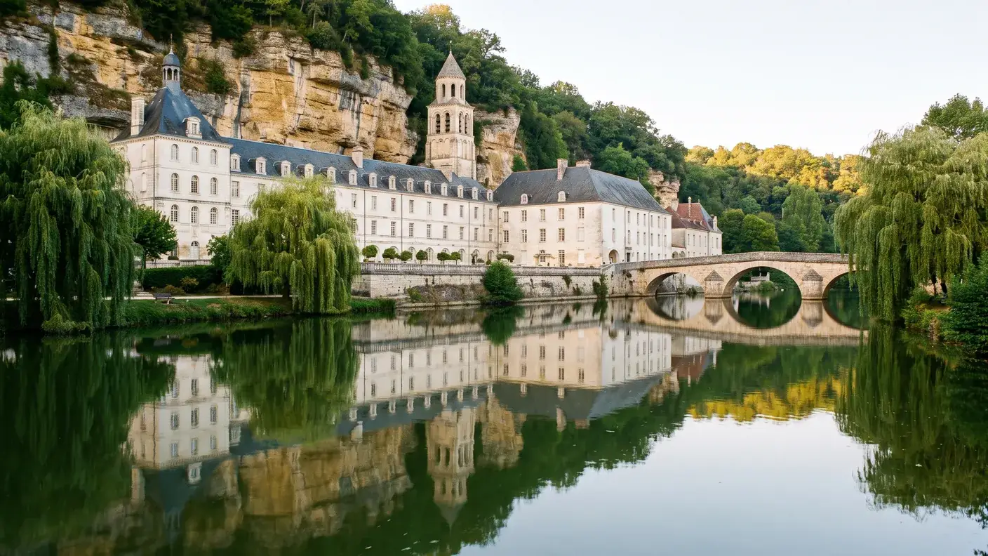
With no rail service and a scattered population, a car is essential here. Cornille serves as a peaceful base from which to explore the Périgord Blanc: the Vesunna Gallo-Roman and the cathedral Saint-Front from Périgueux, the “Venice of the Périgord,” to Brantôme, or Sorges and its Maison de la Truffe. To visit these spots one after another, without worrying about the route or parking, a Executive car service departing from Bordeaux remains the most convenient solution.
Frequently Asked Questions
Where is Cornille located?
In the Périgord Blanc region of the Dordogne, about 10 kilometers northeast of Périgueux (approximately 10 km by road). ZIP code 24750, INSEE code 24135. It is a village with a population of about 687, part of the Le Grand Périgueux urban community, located about 145 km (1 hour 55 minutes) from Bordeaux. There is no train station; the nearest one is in Périgueux.
Why is the population of Cornille growing?
Thanks to the suburban ring effect around Périgueux—from which Cornille is only about ten kilometers away—residents can live in an affordable, rural setting while working in the prefecture’s employment area. The result: strong and sustainable growth, from 275 residents in 1968 to 687 in 2023—a 2.5-fold increase in population, in contrast to the rest of rural Périgord.
Is Cornille an official stop on the Camino de Santiago?
The national profile for the Vézelay route confirms the GR 654, the crossing of the Dordogne River, and the passage through Périgueux, but it does not specifically mention Cornille. The town is therefore presented here as being near this route, not as an official stopover or as a site itself listed as a World Heritage Site.
Is the church in Cornille designated as a historic monument?
The heritage source consulted does not protect the entire church. It lists a crucifix under the identifier POP PM24000153, which was classified as an object on February 20, 1961. It is therefore important to distinguish between the protection of this religious artifact and the status of the building itself, which is not listed in this entry.
Is there a scallop shell sundial in Cornille?
This is a claim that has been circulating, but there are no primary sources to support it, and the available photographs of the church show no evidence of it. We therefore present it as an unverified tradition, not as an established fact. What truly anchors Cornille on the Way of St. James is its documented presence along the Vézelay route.
Why is "Saint-Eumache" sometimes listed as Cornille?
This name is repeated in secondary sources, but the diocese’s 2022 directory lists “Cornille — St-Eutache” and associates Saint-Eumache with Saint-Chamassy. In the absence of more precise local archival records, the guide uses Saint-Eutache for the church in Cornille and presents the accounts regarding Eumache as an unconfirmed tradition.
Is the Fayardie Manor in ruins?
No, that’s a common misconception. On the contrary, the Fayardie Manor is a remarkably well-preserved fortified house, one of the few structures of its kind to have undergone very few alterations. It still features a spiral staircase carved from a single tree trunk, three bretèches, and embrasures. As a private property that houses a pottery studio, it is not open to the public.
How much does a trip from Bordeaux to Cornille cost with a chauffeured transfer?
Starting at €249 for a one-way, door-to-door trip for 1 to 3 passengers (sedan) — approximate fare for ~145 km and about 1 hour and 55 minutes of driving time. The exact price depends on the schedule, the vehicle (sedan or van seating up to 8 passengers), and any requested stops. A fixed, written quote is provided before departure.
Why is a rock from Mars named Cornille?
According to the Wikipedia page for Cornille cited at the end of the article, a rock target analyzed by the Curiosity rover in March 2021 was named “Cornille.” The village in the Périgord region has received this unexpected honor: its name, inherited from a Gallo-Roman landowner two thousand years ago, now appears in the Red Planet’s exploration nomenclature—a cosmic nod to a town with fewer than 700 residents, linking the Périgord Blanc region to the Martian crater explored by the rover.
Who were the Croquants of the Périgord?
Peasants rebelled against the tax burden in two waves: beginning in 1594 (suppressed in September 1595) and then in 1636–1637, during the war against Spain. Led by La Mothe de la Forêt, some 8,000 insurgents captured Bergerac before being crushed on June 1, 1637, at La Sauvetat-du-Dropt by the Duke of La Valette. The last leader, Pierre Grellety, held out from the Vergt Forest until he was granted amnesty in January 1642—before becoming governor of Vercelli, Italy.
What is there to see around Cornille?
Périgueux and its treasures are about ten kilometers away: the Gallo-Roman city of Vesunna and Saint-Front Cathedral, a UNESCO World Heritage Site as part of the Way of St. James. Nearby are Sorges and its Maison de la Truffe (~10 km), and Brantôme, the “Venice of the Périgord” (~16 km). The Lanmary National Forest, right on the village’s doorstep, offers beautiful walks.
Further Reading
- The 2,000-year-old prefecture, just nearby: see the Guide to Périgueux (Vesunna, Saint-Front, UNESCO)
- The “Venice of the Périgord,” about 16 km away: see the Brantôme Guide (abbey, caves, the Dronne River)
- The capital of the Périgord Vert: see the Ribérac Guide (Arnaut Daniel, main market)
- The White Périgord near the Dordogne: see the Montpon-Ménestérol Guide
- Plan your trip: Book a private chauffeur from Bordeaux to Cornille or explore all our destinations
Sources and References
- INSEE — Municipality of Cornille (COM-24135) — Demographic and Population Series 2023; data from 2023, accessed July 24, 2026.
- French Agency for the Ways of St. James — Vézelay Route — Via Lemovicensis, GR 654, crossing the Dordogne River and the gateway city of Périgueux; accessed July 24, 2026.
- Diocese of Périgueux and Sarlat — 2022 Diocesan Directory — “Cornille — St-Eutache” on page 148 and “Saint-Chamassy — St-Eumache” on page 152; accessed July 24, 2026.
- Ministry of Culture, POP — Christ on the Cross (PM24000153) — listed on February 20, 1961; accessed July 24, 2026.
- UNESCO — The Routes of Santiago de Compostela in France — boundaries of the property inscribed in 1998; accessed July 24, 2026.
Article updated in July 2026.
Off to the White Périgord
Direct trip from Bordeaux (~1 hr 55 min) to Cornille and Périgueux, with stops along the way as desired—Vesunna, Saint-Front, Brantôme, Sorges. Written fixed-price quote within 30 minutes; sedan or 8-passenger van; English-speaking driver.